- 10.
 95
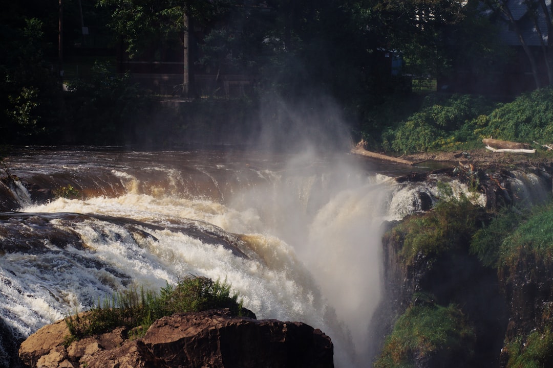
95Paterson Great Falls
A 77-foot waterfall in urban New Jersey, second in the East only to Niagara by volume. Alexander Hamilton chose this site to power America's first planned industrial city; the ruins of those mills still line the raceway. Three overlook platforms offer different angles on the falls. The whole park takes an hour if you read every sign; less if you just want to see water crash over basalt. Free admission, free parking, and back on the highway in time for lunch.
Explore:Park Profile - 9.
 96
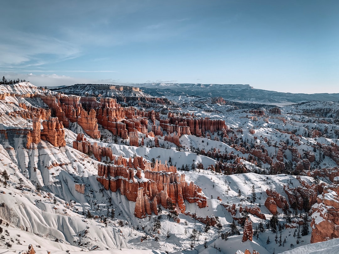
96Bryce Canyon
Fourteen amphitheaters of red rock spires called hoodoos, carved by ice and erosion into shapes that seem impossible. The rim road hits all the major viewpoints in 18 miles. Sunrise Point, Sunset Point, Inspiration Point, Bryce Point: each offers a slightly different angle on the same impossible geology. The Navajo Loop Trail descends among the hoodoos and returns via Queens Garden in under three miles. Watch the sunrise turn the rocks orange, hike to the canyon floor, be on your way to Zion by afternoon.
- 8.
 96
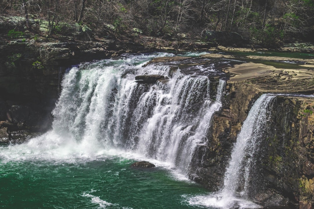
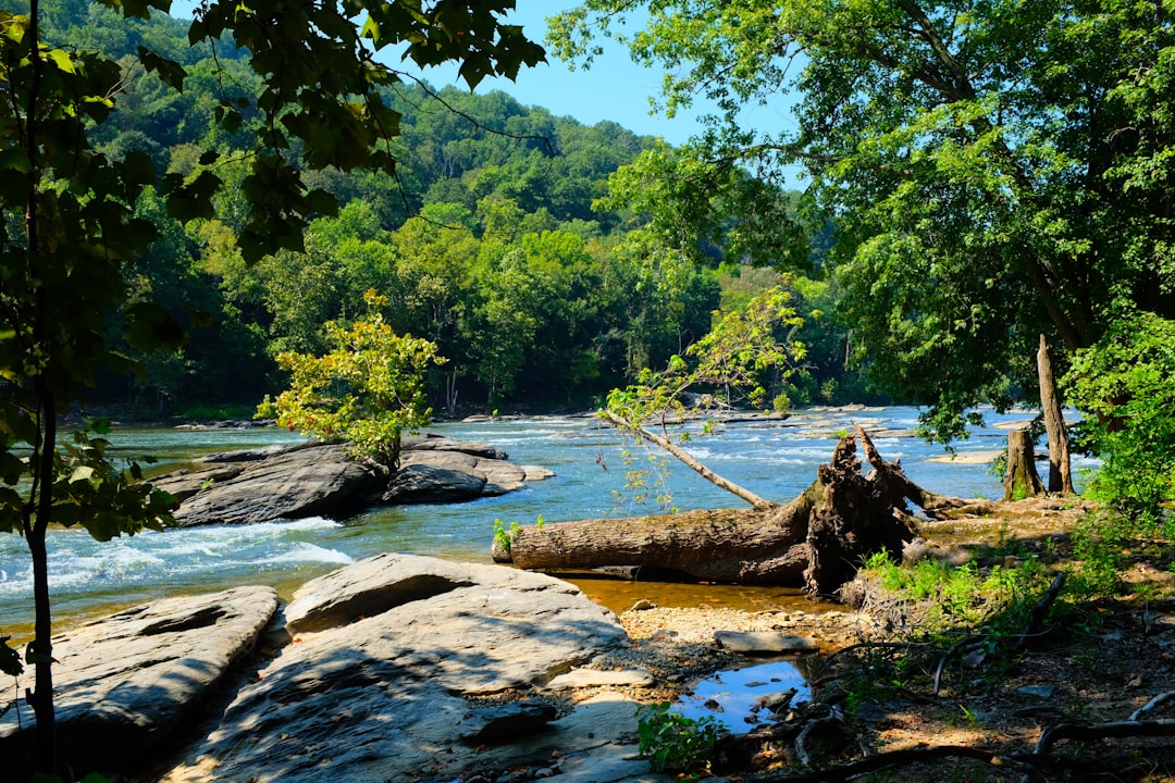
96Highlight’s Favorite: Little River Canyon
Little River Canyon scores ninth on this list, and it’s our favorite for day trips.
The deepest canyon east of the Mississippi, carved into the southern Appalachians where Alabama meets Georgia. Canyon Rim Parkway runs 23 miles along the edge with overlooks every mile or two. Little River Falls drops 45 feet at the upper end. Grace’s High Falls adds another 133 feet for those willing to hike. Drive the rim, stop at the waterfalls, and the whole thing fits comfortably into a morning.
Most people associate Alabama with Gulf Coast beaches, not canyon country. Little River Canyon doesn’t show up on anyone’s national park bucket list, which is exactly what makes it a good day trip: no reservation systems, no timed entry, no crowds complicating the logistics. Show up, drive the rim, see the waterfalls, leave. That’s what a day trip is supposed to be.
Explore:Park Profile - 7.
 97
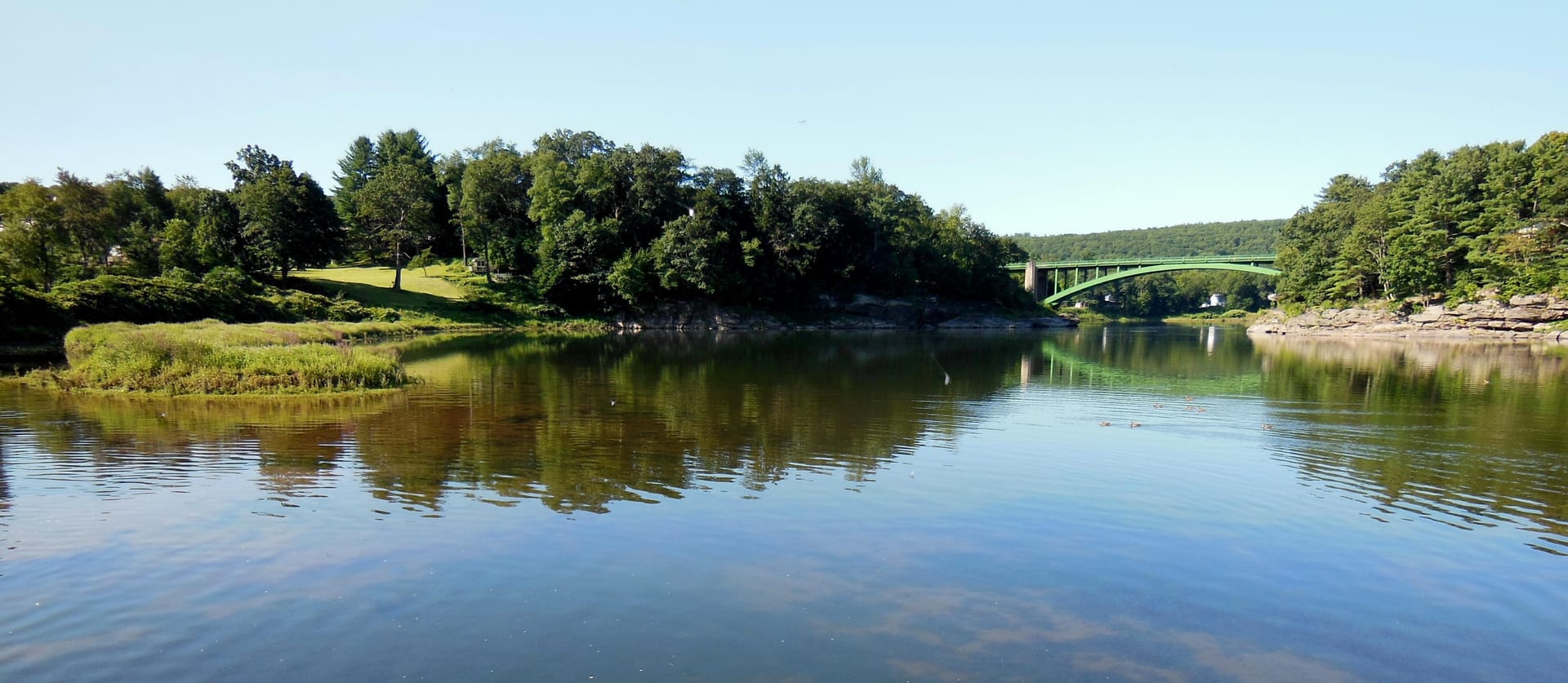
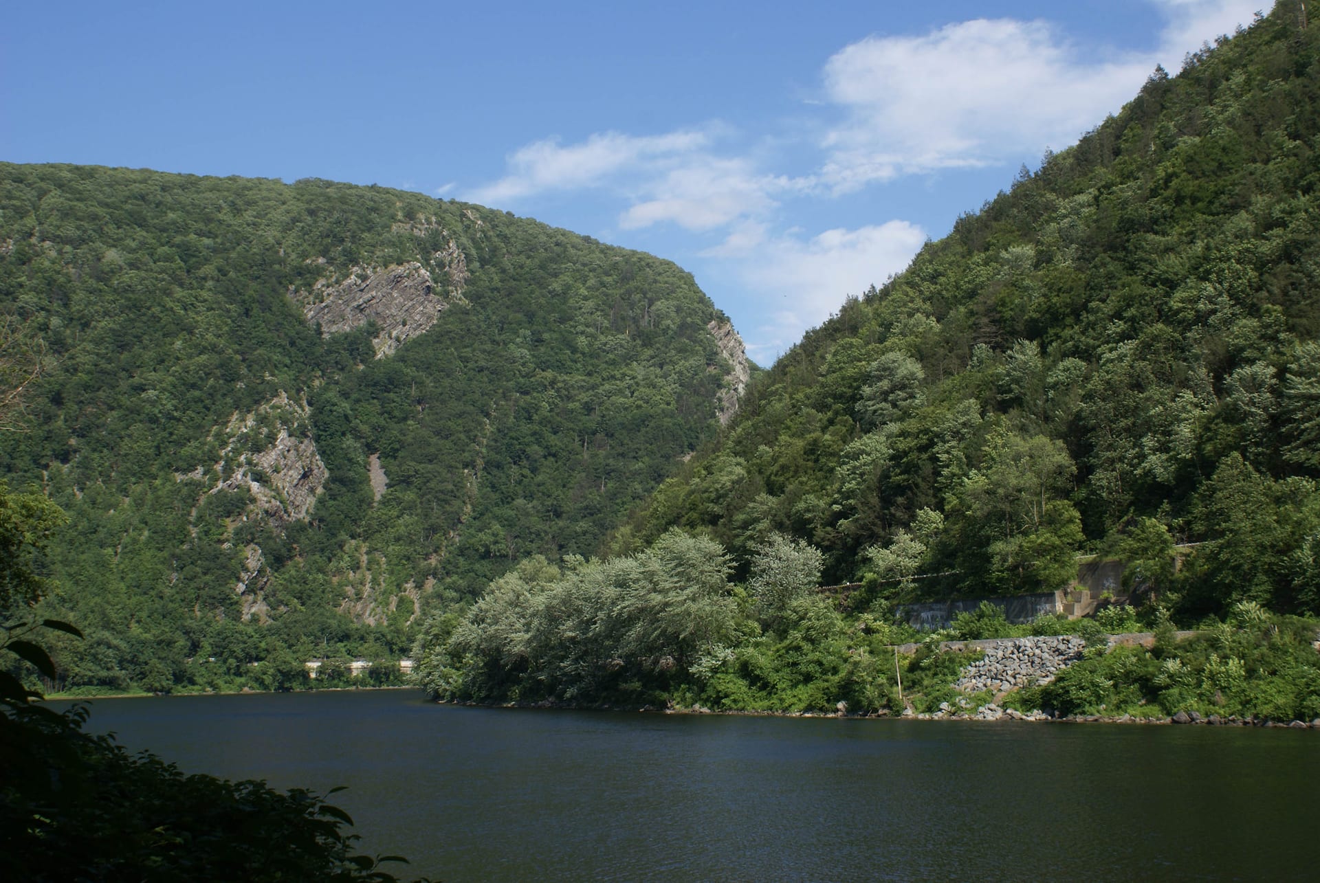
97Upper Delaware
The longest free-flowing river in the Northeast, winding 73 miles along the New York-Pennsylvania border. Outfitters in Narrowsburg and Barryville rent canoes and kayaks with shuttle service. Float downstream past hemlock forests and farmland, through mild rapids and quiet pools. The Roebling Bridge, predecessor to the Brooklyn Bridge, still spans the river at Lackawaxen. Paddle in the morning, return the boat by afternoon, drive back to the city by dinner.
Explore:Park Profile - 6.
 97
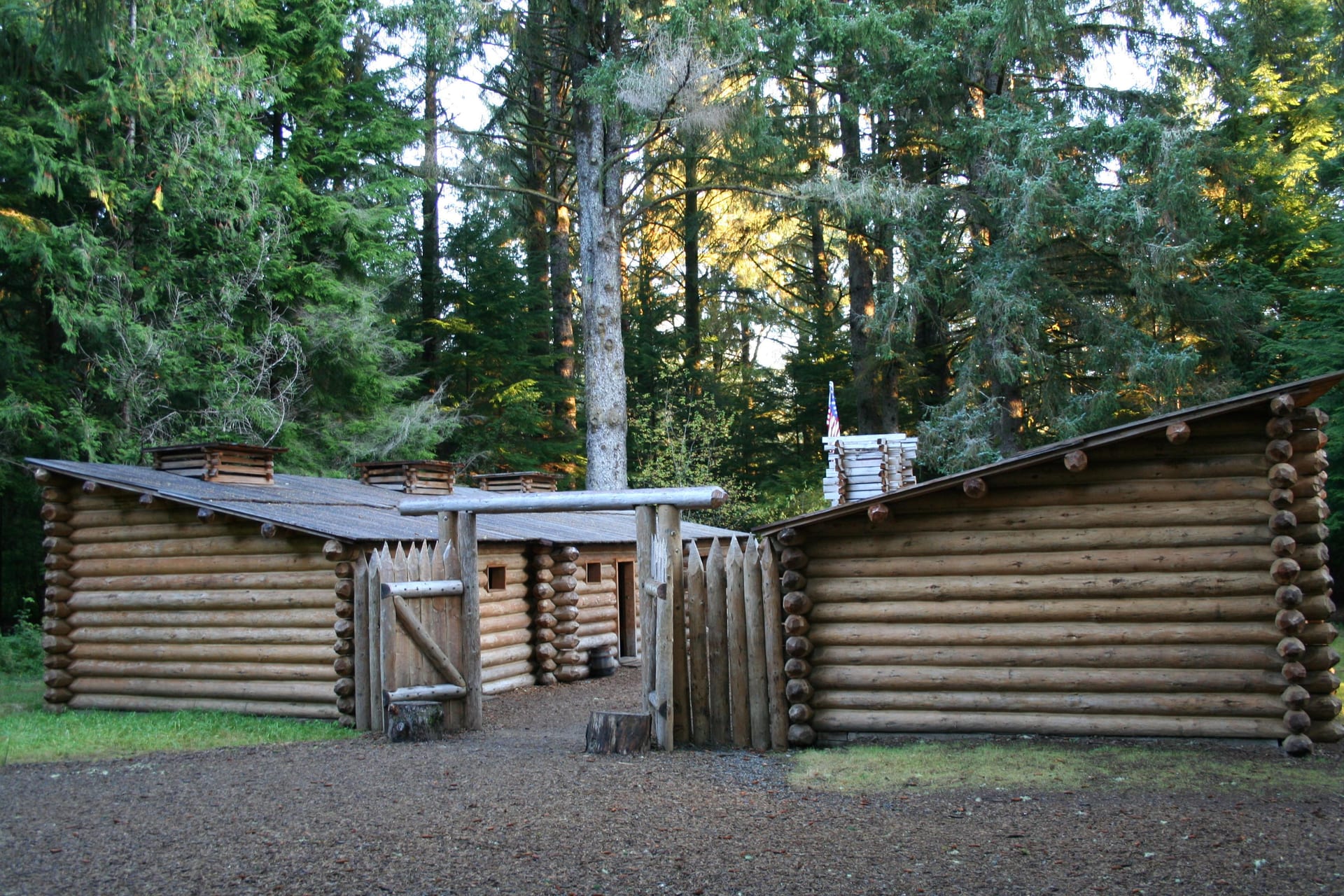
97Lewis and Clark
Where the Columbia River meets the Pacific, marking the end of the expedition that mapped the American West. Fort Clatsop is a reconstruction of the 1805 winter camp, complete with ranger demonstrations of 19th-century skills. The park stretches across both sides of the river, from Astoria's maritime heritage to the headlands where Lewis first saw the ocean. Visit the fort, walk the beach, eat Dungeness crab in Astoria. The whole experience fits between breakfast and dinner.
Explore:Park Profile - 5.
 98
98Harpers Ferry
History and hiking concentrated into a walkable town where two rivers meet. John Brown's raid started in the fire engine house still standing on the main street. The Appalachian Trail crosses the Potomac on a footbridge beside the railroad trestle. Maryland Heights offers the classic view from 1,400 feet above the confluence. Walk the cobblestone streets, hike to the overlook, catch the train back to Washington. A full experience packaged into a few hours.
Explore:Park Profile - 4.
 98
98Middle Delaware
Forty miles of the Delaware River between Pennsylvania and New Jersey, free-flowing through the only break in the Appalachian ridgeline. Rent a canoe in Milford or Dingmans Ferry, float downstream, and arrange a shuttle back. The water moves slowly enough for beginners; the scenery changes enough to stay interesting. Bald eagles nest along the banks. Osprey fish the shallows. Return the boat by afternoon and still have time for dinner in the Poconos.
Explore:Park Profile - 3.
 99
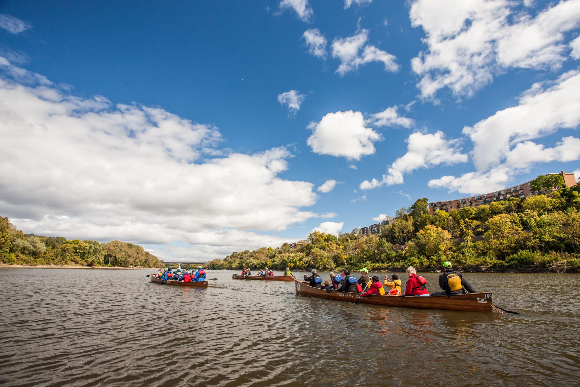
99Mississippi
Seventy-two miles of the Mississippi River threading through the Twin Cities, from suburban parkland to downtown Minneapolis. Minnehaha Falls is the most visited site, a 53-foot waterfall in a limestone gorge that Longfellow made famous without ever seeing. The Stone Arch Bridge crosses the river where St. Anthony Falls once powered the flour mills that made Minneapolis. Rent a kayak, paddle past the downtown skyline, grab dinner in Northeast. Urban river recreation packaged for an afternoon.
Explore:Park Profile - 2.
 99
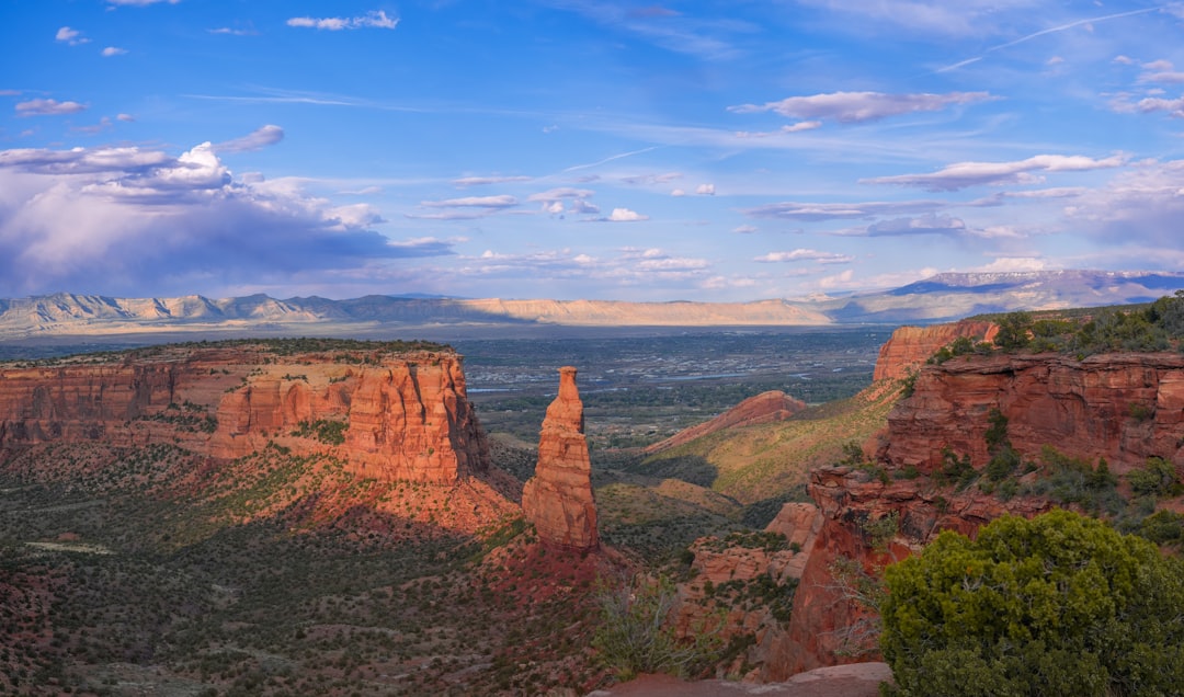
99Colorado
Rim Rock Drive runs 23 miles along the edge of sheer sandstone cliffs above Grand Junction, with pullouts at every major viewpoint. The canyon walls drop 500 feet in places, red rock towers rising from the valley floor like a scaled-down Grand Canyon. Monument Canyon Trail descends from the rim to the canyon floor and back in four miles. Independence Monument stands 450 feet tall, one of the most photographed formations in the West. Drive the whole thing in two hours; add a hike and make it half a day.
- 1.
 100
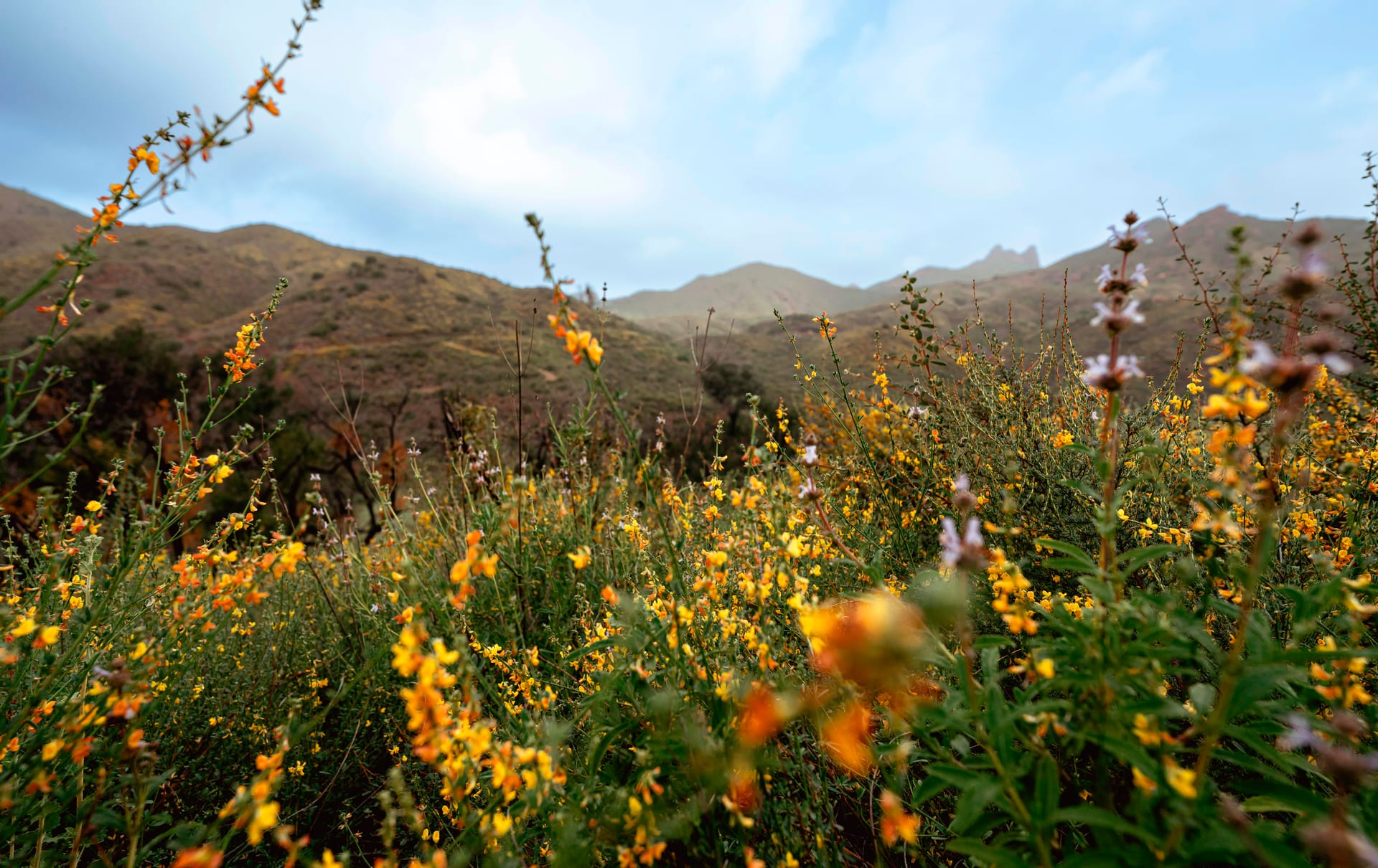
100Santa Monica Mountains
Los Angeles sprawls to the edge of these mountains and stops. Griffith Observatory sits on the eastern end; Point Mugu marks the western limit. In between: 500 miles of trails through chaparral-covered ridges, oak woodlands, and coastal canyons. Malibu Creek State Park has the rock pool where M*A*S*H was filmed. Topanga State Park offers city views from 2,000 feet. The whole recreation area sits inside the LA metro, accessible by freeway, hikeable in an afternoon, back to civilization by sunset.
Explore:Park Profile
185 parks scored on 85 criteria
Discover your perfect park
Find a destination that matches how you actually want to travel.
Get Started