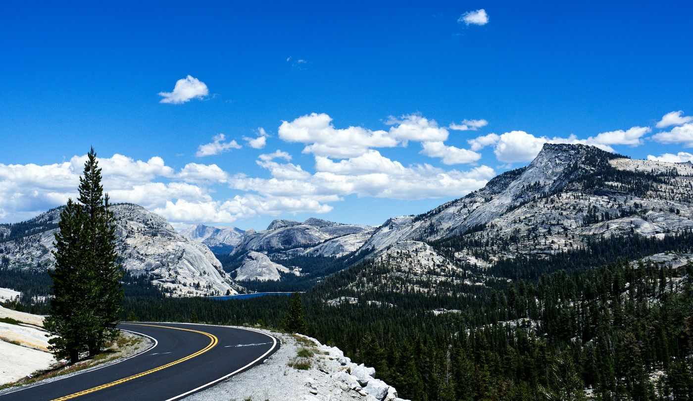
While most visitors crowd into Yosemite Valley, Tioga Road offers the park's high country: granite domes polished by glaciers, lakes reflecting peaks, and Tuolumne Meadows stretching toward the horizon at 8,600 feet. The road was originally a mining route, improved in the 1960s to its current alignment. It climbs from the west side's mixed forests through subalpine terrain to Tioga Pass at 9,945 feet, the highest highway pass in the Sierra Nevada. The landscape here has more in common with the alpine West than with the Valley's waterfalls and cliffs. For many, this is the real Yosemite.
Parks Along the Way
Yosemite National Park
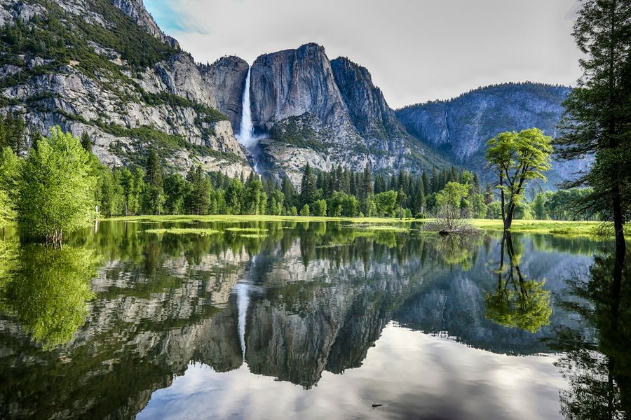
Drive Tioga Road, hike in Tuolumne Meadows, and spend at least a day in Yosemite Valley for the waterfalls and iconic views.
Notable Stops
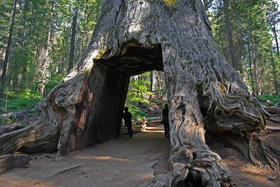
Tuolumne Grove
A grove of giant sequoias including the Dead Giant Tunnel Tree, which you can walk through. The grove has about two dozen sequoias, less crowded than Mariposa Grove. A one-mile downhill walk to reach them means an uphill return.
1-2 hours
Siesta Lake
A small lake right beside the road, good for a quick photo stop. The still water reflects the surrounding forest. Not a major destination, but an easy leg-stretch as you climb toward the high country.
10-15 minutes
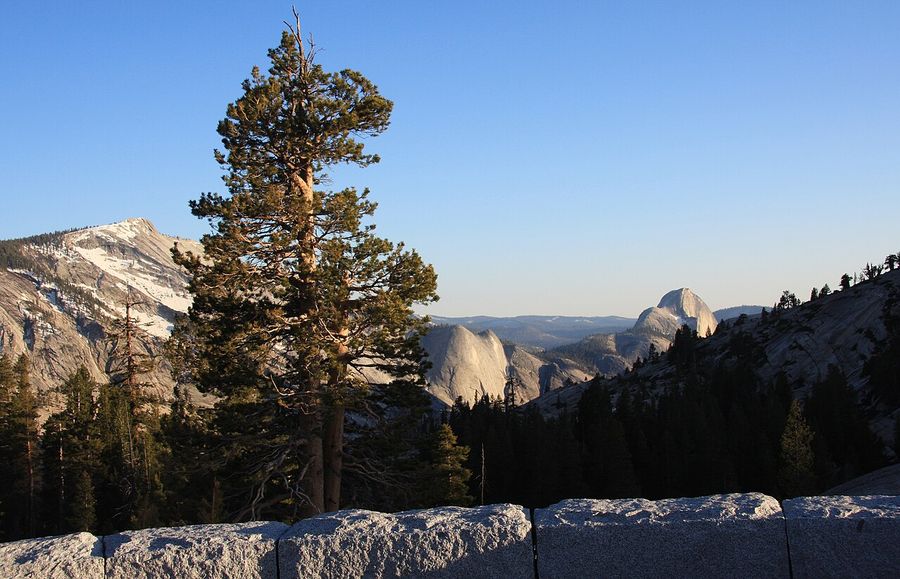
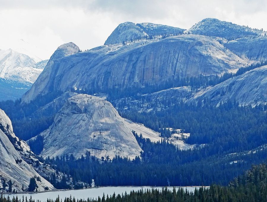
Olmsted Point
Named for Frederick Law Olmsted, who helped establish Yosemite as protected land. Views of Tenaya Canyon, Clouds Rest, and a distant Half Dome from an angle most visitors never see. Erratic boulders left by glaciers dot the granite slopes. One of the most photogenic stops on the road.
30 minutes
Tenaya Lake
The 'Jewel of the High Country' at 8,150 feet. The largest natural lake in Yosemite, clear and cold. A sandy beach on the east end allows swimming for those willing to brave the temperature. Kayaking and stand-up paddleboarding are popular. The lake is steps from the road.
30 minutes to 2 hours
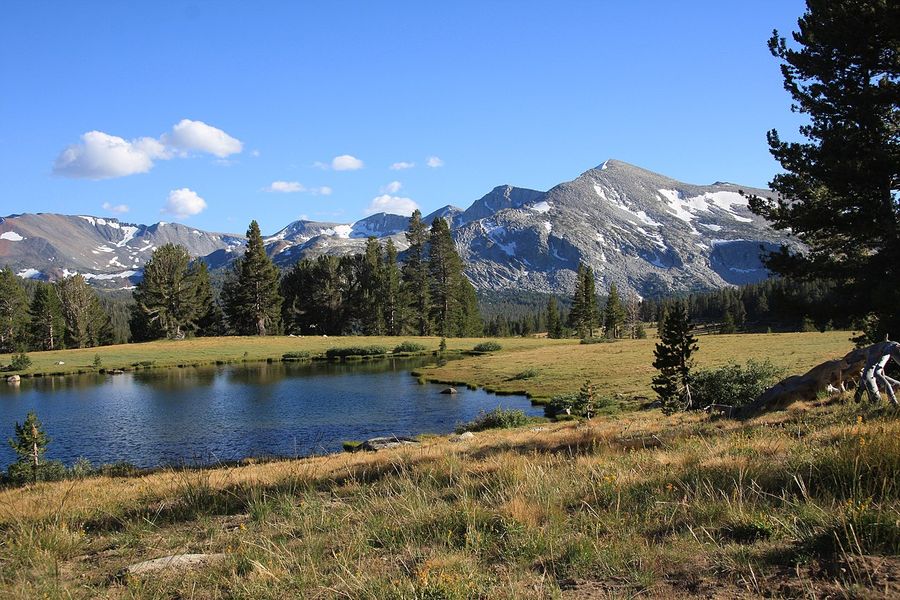
Tuolumne Meadows
The largest subalpine meadow in the Sierra Nevada, stretching for miles at 8,600 feet. The Tuolumne River winds through. Lembert Dome rises to the north; Cathedral Peak to the south. A visitor center, store, and campground provide services. This is the hub of the high country and the trailhead for dozens of backcountry routes.
1-4 hours depending on hiking
Soda Springs and Parsons Memorial Lodge
A half-mile walk from the road to a naturally carbonated spring bubbling up through the meadow. Parsons Lodge, built by the Sierra Club in 1915, sits nearby. John Muir camped at these springs. Easy walking through the meadow with views of the surrounding peaks.
45 minutes to 1 hour
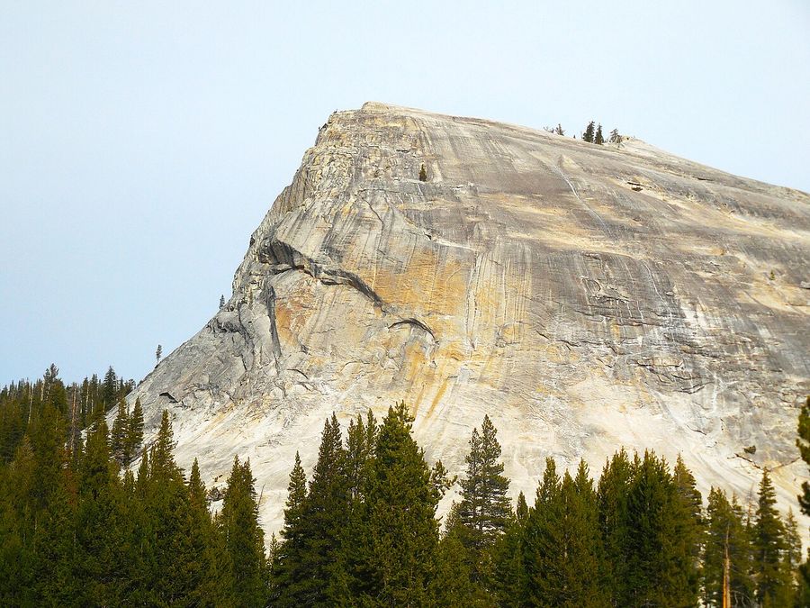
Lembert Dome
A granite dome rising above Tuolumne Meadows. The 2.8-mile round-trip hike to the 9,450-foot summit is moderately strenuous but rewards with panoramic views of the meadows, the Cathedral Range, and the High Sierra. Glacial polish makes the rock surface slippery when wet.
2-3 hours for hike
Dana Meadows
High meadows below Mount Dana and Mammoth Peak. Snow lingers on the peaks into summer. The meadows turn green in July, yellow in September. A scenic drive-through with pullouts for photos. The approach to Tioga Pass begins here.
10-15 minutes
Tioga Pass
At 9,945 feet, the highest highway pass in the Sierra Nevada. The park boundary lies here. East of this point, the road descends dramatically toward Mono Lake and the Eastern Sierra. The entrance station marks the transition from Yosemite to the high desert.
10-15 minutes
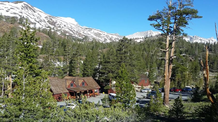
Tioga Pass Resort
A historic lodge and cafe just outside the park since 1914. Breakfast, coffee, and pie. Simple cabins for those who want to stay at the pass. Closed in winter when the road is impassable. A good stop before or after the park.
45 minutes to 1 hour
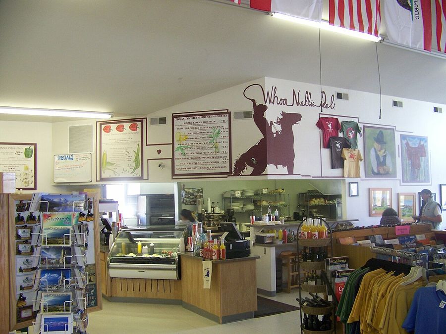
Whoa Nellie Deli
World-famous gas station food at the Tioga Gas Mart. Fish tacos, lobster taquitos, and an outdoor patio with Mono Lake views. Live music on summer evenings. The unlikely combination of Mobil station and destination restaurant works because the food is genuinely good.
1 hour
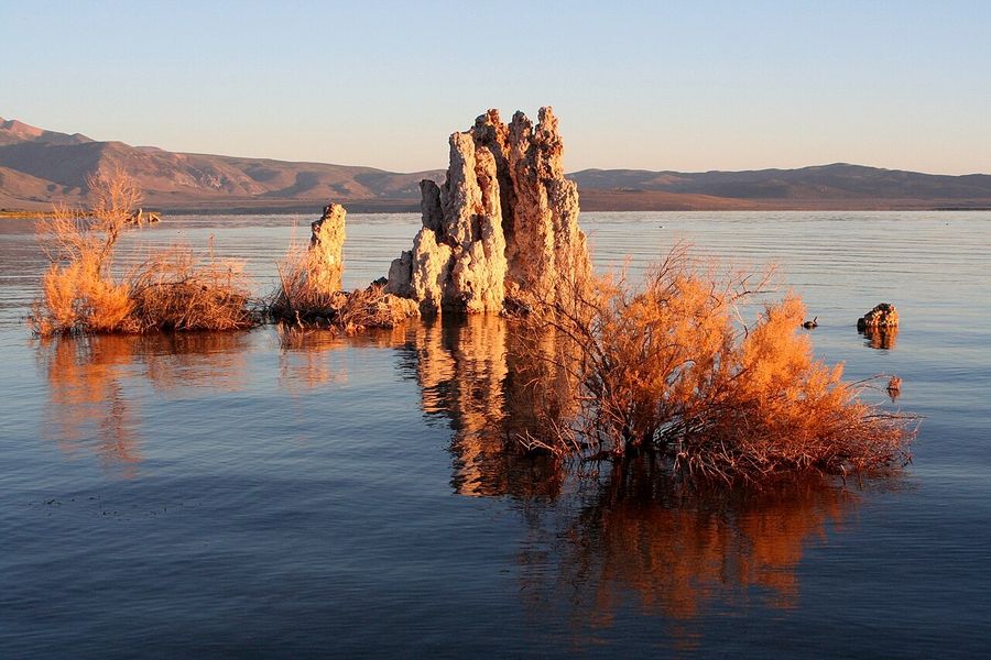
Mono Lake Tufa State Natural Reserve
A 760,000-year-old lake with no outlet, three times saltier than the ocean. The tufa towers are calcium carbonate spires formed underwater, now exposed by falling lake levels. An alien landscape 10 miles from Yosemite's eastern boundary. The South Tufa area has the best access.
1-2 hours
Pro Tips
- Check road status before planning your trip. Tioga Road closes for winter, sometimes not opening until late June or early July after heavy snow years.
- Gas is available at Crane Flat (west end) and the Tuolumne Meadows Store (summer only). Fill up before crossing the park.
- The elevation at Tuolumne Meadows is 8,600 feet. Drink water and take it easy on hikes until you acclimatize.
- A free shuttle runs between Tuolumne Meadows and Olmsted Point during summer, stopping at major trailheads.
- The east side of the pass descends 3,000 feet in 12 miles. Brake carefully and watch your temperature gauge.
- Lee Vining and the Eastern Sierra are worth extending your trip. Mono Lake and Bodie Ghost Town are within easy reach.